Prototype C Now Available

Prototype C is up now! This is the final update for this project. The big change this time? Full map data and tiles!

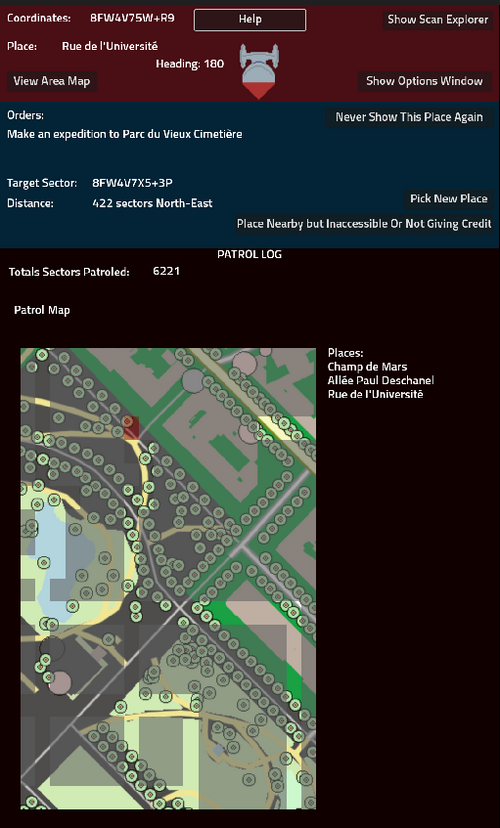
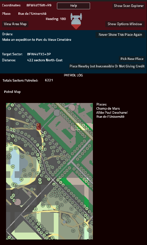
Now, you can choose to download the map data for the area around you, and the game client will use it to create detailed map tiles on the fly. In the screenshot above, we're in the Champ de Mars park in Paris near the Eiffel Tower, and you can see every tree lining the roads around it, and each curve in the paths around. These are drawn in Godot, on the phone itself, when needed. In addition, the game can now display the names of all places in your current cell, not just the smallest gameplay-relevant one.
As a final change, the game will now use smaller cells to indicate your current position when possible. If your GPS accuracy is 6 meters or less. This should generally mean that the Cell11 highlighted as your current position is either the one you're at, or one of its immediate neighbors in most parts of the world.
This project was incredibly important in developing PraxisMapper's Godot components. Moreso than simple GPS checks and pulling data from a server, this enables them to do more of the work on-device, which helps protect the user's privacy in addition to reducing data usage by the client.
RELEASE C NOTES:
- Full Map Data support enabled.
- You will have to download files in order to use full map data. It’s a single button on the main screen. It’ll pull down 1 zip file that contains 400 sub-files the game uses to draw accurate map tiles. You will only be prompted to download data if you do not have data available for the area.
- I have a server up, but in the event that the server goes down, it is possible to create the data files with PraxisMapper and host them. If necessary, set this server URL in the Options screen. For now, leave it as it is.
- The Patrol Log will draw and show the nearby area for your current PlusCode if the full map data is present, as well as list all named places you’re located at instead of only gameplay places.
- The Area Scanner will use the full map data if present, showing significantly more types of places around you. The game should only use the same types of places as the minimized data set does.
- When possible, the game will use 11 digit PlusCodes to indicate your current location in text and on the Patrol Log. The list of places should still use the Cell10, to help identify roads and points without being directly on top of them.
Files
Get Weekend Space Command (Prototype)
Weekend Space Command (Prototype)
A new kind of location based game, for Android devices.
| Status | Prototype |
| Author | Cerol |
| Tags | android, location-based, locative, No AI, offline, Open Source |
| Languages | English |
More posts
- Research Fleet:Control - Announcement and Tech PreviewOct 22, 2024
- Minimized Map Data Now Available SeparatelyMay 26, 2024
- Prototype C DelayedMay 19, 2024
- How to compress map data by by 99.9998%Apr 19, 2024
- Release B Available!Apr 13, 2024
Leave a comment
Log in with itch.io to leave a comment.